Two Months Live Workshop(Feb To March)
Landuse and Landcover (LULC) Mapping using Conventional and Machine Learning approaches and its Prediction by Cellular Automata Markov Chain model
Landuse and Landcover (LULC) Mapping using Conventional and Machine Learning approaches and its Prediction by Cellular Automata Markov Chain model
Prepare LULC maps using, Supervised, Unsupervised, Combined classification methods and ML Approaches and future prediction by CA Markov Chain model
ABOUT COURSE
In this online workshop and live practice, you can learn the complete process (A-Z) from scratch to production. Step by step guide of downloading satellite images, its processing, classification, change detection and future prediction using CA-Markov chain of Land Use Land Cover (LULC) in Erdas Imagine, Arc GIS and Terrset Environment. How to select parameters and why, download raster and vector data and process using different software. You will also learn the accuracy assessment of the LULC map using Kappa Statistics in Erdas Imagine software.
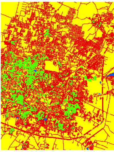
Land Use Land Cover (LULC)
Land Use Land Cover (LULC) applications involve both baseline mapping and subsequent monitoring, since timely information is required to know what current quantity of land is in what type of use and to identify the LULC changes from year to year. This knowledge will help develop strategies to balance conservation, conflicting uses, and developmental pressures. Issues driving land use studies include the removal or disturbance of productive land, urban encroachment, and depletion of forests. Also, it plays a significant and prime role in planning, management, and monitoring programs at local, regional, and national levels. This type of information, on one hand, provides a better understanding of land utilization aspects and on the other hand, it plays an important role in the formation of policies and programs required for development planning. For ensuring sustainable development, it is necessary to monitor the ongoing process of land use/land cover pattern over a period of time. In order to achieve sustainable urban development and to check the haphazard development of towns and cities, it is necessary that authorities associated with urban development generate such planning models so that every bit of available land can be used in the most rational and optimal way. This requires the present and past LULC information of the area. LULC maps also help us to study the changes that are happening in our ecosystem and environment. If we have an inch-by-inch information about LULC of the study unit we can make policies and launch programs to save our environment.
Keywords: LULC; Supervised; Unsupervised; Combined Classification; RF; SVM; LULC Change detection; CA Markov Chain
Course Curriculum
- 1. Introduction to satellite images, Google earth and LULC
- 2. Software required and its downloading technique
- 3. Linking Google Earth with Erdas Imagine
- 4. Literature review for LULC prediction
- 5. Selection of relevant criteria for LULC prediction
- 1. How to select study area
- 2. How to prepare location map of the study area
- 3. How to prepare flow diagram
- 1. Download Satellite images
- 2. Processing of satellite images in Erdas Imagine
- 3. Processing of satellite images in ArcGIS
- 4. Enhancement of the processing Images
- 5. Mosaic of the of the Images
- 6. Removing black pixel
- 7. Cut study area
- 1. Utilization of different methods of LULC
- 2. Preparation of LULC map using Supervised classification in Erdas Imagine
- 3. Preparation of LULC map in Erdas Imagine using Unsupervised classification in Erdas Imagine
- 4. Preparation of LULC map in Erdas Imagine using Combined method in Erdas Imagine
- 5. Preparation of LULC map in ArcGIS
- 1. Downloading high resolution images
- 2. Processing the images
- 3. Installing SVM
- 4. LULC classification using SVM
- 5. LULC classification using RF
- 1. Recoding of LULC map
- 2. Error pixel correction and new class generation
- 3. Calculate area of LULC classes
- 4. Change detection of LULC
- 5. Change detection matrix in excel
- 6. Accuracy assessment of the LULC map
- 7. Thematic error correction
- 1. Download required data from different sources
- 2. Preparation of LULC related drives for prediction
- 3. Roads processes
- 4. DEM processes
- 5. Processes LULC map for prediction
- 1. Arrange data for batch processing
- 2. Adding optional layer to maintain data
- 3. Conversion of file for Terrset
- 4. Setting up Land Change Modeler
- 5. Testing the power of the drivers
- 6. Running the machine learning and MLP Model
- 7. Prepare future LULC using CA-Markov chain
- 1. Validation of the outcome
- 2. Modification of future images with matrix probability
- 3. Understanding model setting
- 4. Convert Terrset files for ArcGIS
- 5. Preparation of the figures
- 6. Preparation of the Tables
- 7. Preparation of final output
- 1. Feedback
- 2. Final layout of article
Benefits of Online International Workshop
During this workshop, participants can prepare, process, predict and validate LULC map, change detection and prediction
Publication support from SCOPUS Index Journal
Provide supporting resources like ppt, code, research articles
- Instructors continuous support, taking your hand step-by-step to develop high-quality prediction maps using real data
- Live WhatsApp Chatting with the instructor
- 1:1 Sessions with experts
- Lifetime access
Access recorded class videos of any time
Instructor: Mr. T. Mandal, WhatsApp- +91 94740 86902

Ready to enroll Online certificate Course?
Landuse and Landcover (LULC) Mapping using Conventional and Machine Learning approaches and its Prediction by Cellular Automata Markov Chain model
Course option


Why Learn With us?
Over two decades of experience and expertise in teaching Tech and coding helping students develop their tech skills for higher performance, better careers and growth in companies.
Read More
Why Learning With us?
World Class Teachers
Get certified with our premium courses and get started on your journey to a brand new career altogether
Certifications
Get certified with our premium courses and get started on your journey to a brand new career altogether
Students Community
Get certified with our premium courses and get started on your journey to a brand new career altogether
Live session
Get certified with our premium courses and get started on your journey to a brand new career altogether